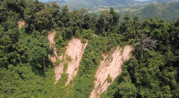
The Tiwingan Hill Landslide is in the Riam Kanan Lake area, Tiwingan Lama Village, Aranio District, Banjar Regency. It is 25 km from Banjarbaru City by motorcycle or car to Tiwingan Riam Kanan port, proceed by an engine boat or what the local community calls “Klotok”. It was a geological occurrence phenomenon, composed of rocks such as schist, quartzite originating from the Metamorphic Rock Group aged 180-135 million years ago (Middle-Late Jurassic) and some part of it is weathering, making a very steep slopes/cliffs landscape. The weathered rocks diversified as Red Yellow Podzolic, Litosol and Latosol soil types, where this type of soil is classified as infertile/less fertile and has a sandy texture, so if there are no trees and plants that bind it, coupled with a high intensity of rainfall and a high level of the steepness of the slope, it will slide easily. This location can be seen on boat/klotok on Riam Kanan Lake.